
Spiritual6 days
Tawang and Bomdila Buddhist circuit
Monasteries, high passes and lakes across West Kameng and Tawang.
- Tezpur
- Bomdila
- Dirang
- Tawang
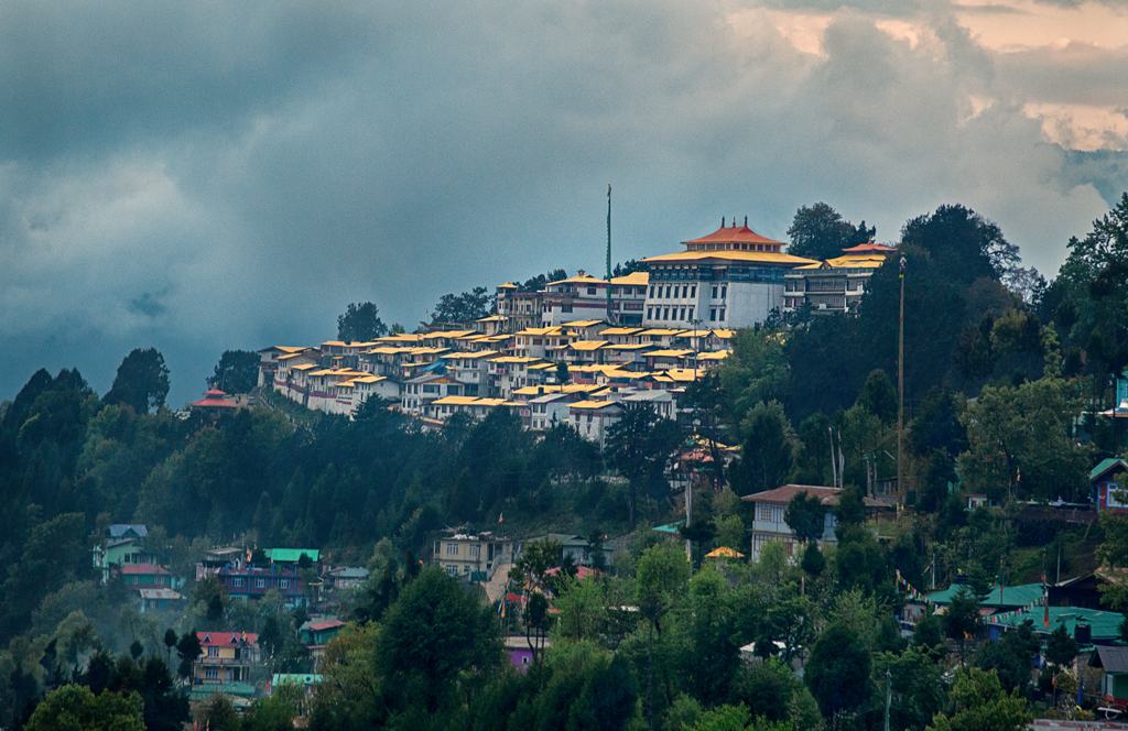
Land of the dawn-lit mountains, monasteries and tribal valleys
India's easternmost state mixes Himalayan passes, Tawang's great monastery, Ziro's rice-fields, Apatani and Monpa cultures, and rivers like the Siang. Remote, rewarding and mostly permit-controlled.
India's largest monastery, a Gelug Buddhist seat in the high Himalaya.
High pass of about 13,700 ft with a frozen lake and prayer flags.
Border viewpoint and glacial lake near Tawang, with army permission.
Paddy fields, pine ridges and Apatani villages; a UNESCO tentative site.
Rare tiger-leopard-snow leopard habitat in Changlang's jungle.
Monastery town with apple orchards and mountain views.
Gateway to white-water rafting and Adi tribal culture.
Warm valley with hot springs and a Monpa dzong.
Join the dots: each circuit links places that make sense together.
Monasteries, high passes and lakes across West Kameng and Tawang.
Apatani paddy-fish culture, music festivals and pine hills.
River sports and Adi villages along the Siang.
Jungle trails and a Hindu pilgrimage site on the Lohit.
Remote Mishmi territory and the Mayodia Pass.
The city's fort, museum and Buddhist temples.
27 districts. Open any to see what's worth your time — gold tags mark lesser-known places.
Administrative capital area (Itanagar-Naharlagun), not a standard district.
Plains district around Itanagar and Doimukh.
Newly formed hill district carved out of Lower Subansiri.
Home of the Apatani valley and its music festival.
New district, carved out of Lower Subansiri.
Remote Nyishi district north of Papum Pare.
Remote high-altitude hill district.
Home to the Tagin tribe and the Subansiri valley.
Gateway to Tawang with monasteries and apple orchards.
Remote district rich in forest and Nyishi culture.
Home to Pakke Tiger Reserve and its hornbills.
High-altitude Monpa district with India's largest monastery.
Adi homeland with quiet river valleys and cane bridges.
New district carved from West Siang, the Galo heartland.
Remote high-altitude district bordering China.
Mid-Siang plateau district with river-gorge views.
Home to the Siang's gorges and Adi culture.
Gateway to the Siang river, rafting and Adi culture.
River-plain district at the Assam border.
Tai-Khamti and Singpho buddhist district.
Mishmi district on the Brahmaputra headwaters.
Easternmost district where the sun first rises.
Namdapha and Tangsa-Singpho country.
Wancho and Nocte tribal hills on the Myanmar border.
Hilly district of Nocte and Wancho tribes.
Mishmi highlands, among India's least-populated regions.
Gateway to Mishmi hills and lakes.
Nothing matches — try a different word.
Homestays in Ziro and Tawang, small hotels, and forest rest houses in the east.
Roads wash out in monsoon and snow blocks passes in winter; build buffer days into every itinerary.
Tell us the circuit, the season and your pace — we'll shape it into a private itinerary. Permits, stays and transfers handled.
Start planning Free trip plannerCompiled from public tourism information and our own knowledge; permits, entry rules, district boundaries, timings and prices change — approximate, verify before travelling. Last reviewed 2026-11-09.