
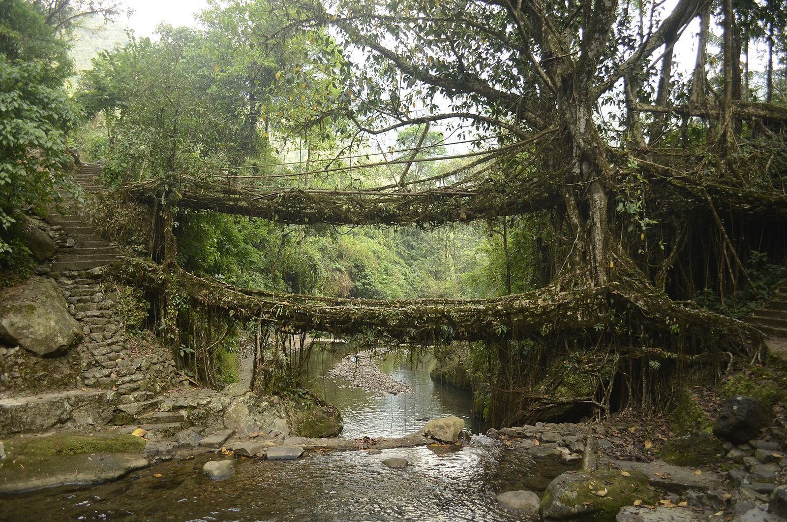
Meghalaya: bridges grown from roots, forests kept by communities
In the Khasi Hills, people have grown bridges for generations and protected groves for centuries. November's dry weather is the time to walk to them.
Meghalaya, formed in 1972 from part of Assam, takes its name from the Sanskrit for abode of clouds. It is among the wettest places on earth, with Cherrapunji (Sohra) holding the record for the most rain in a calendar month and nearby Mawsynram the record for a year. About 70 per cent of the state is forested, and its three largest communities, the Khasi, Garo and Jaintia, follow matrilineal custom: lineage and inheritance pass through women, and the youngest daughter inherits the family property.
The state's most unusual landscape feature is the living root bridge. Builders guide the aerial roots of the rubber fig, Ficus elastica, across a stream or gorge, using hollowed areca palm trunks and bamboo scaffolding for support; further roots are woven in to make steps and railings. A bridge can take decades to become strong enough to carry people, and many in use are very old. A 2019 mapping recorded 75 bridges, and the heritage committee at the centre of our People profile has mapped more than 132. The bridges were put on India's tentative list for UNESCO World Heritage status in 2022, which is a first step and not an inscription.
The best-known one, the double-decker bridge near Nongriat, is reached by a steep descent on stone stairs. Meghalaya Tourism advises that the trek is not recommended for people with vertigo, and one published account puts the walk at roughly two and a half hours each way, with stair counts that vary by source. Less-visited bridges around Rangthylliang and Mawkyrnot offer quieter walks. Tourism is also the main threat: reporting records popular bridges being reinforced with concrete or steel and paths being paved, while less-visited bridges are neglected.
For a different kind of heritage, spend a morning at Mawphlang sacred forest, about 25 kilometres from Shillong. Khasi communities protect groves like this one as religious sites, and visitors are asked to take nothing out of it, not even a twig; a local guide is effectively required, and entry and guide fees quoted in different sources vary, so confirm on the day.
Dates for planning: the Shillong Cherry Blossom Festival is scheduled for 20 and 21 November 2026 at the New Shillong Highland Grounds, according to news reports, with ticketed music performances. Book accommodation early if you plan to be in Shillong then.
Practical notes: Indian visitors do not need an Inner Line Permit for Meghalaya, but a 2019 amendment to the state's safety and security law, as reported then, requires non-residents staying more than 24 hours to register; we could not confirm the current process, so check with Meghalaya Tourism. Best months are October to April. Stay in homestays, hire local guides, and treat the bridges as village property, not a gym.
Prices, dates, permits and rules change — approximate, verify before you travel. Researched from public sources; field verification pending.
Planning a journey like this?
Tell us the season and your pace — we'll shape it into a private itinerary.
Talk to a travel designer